

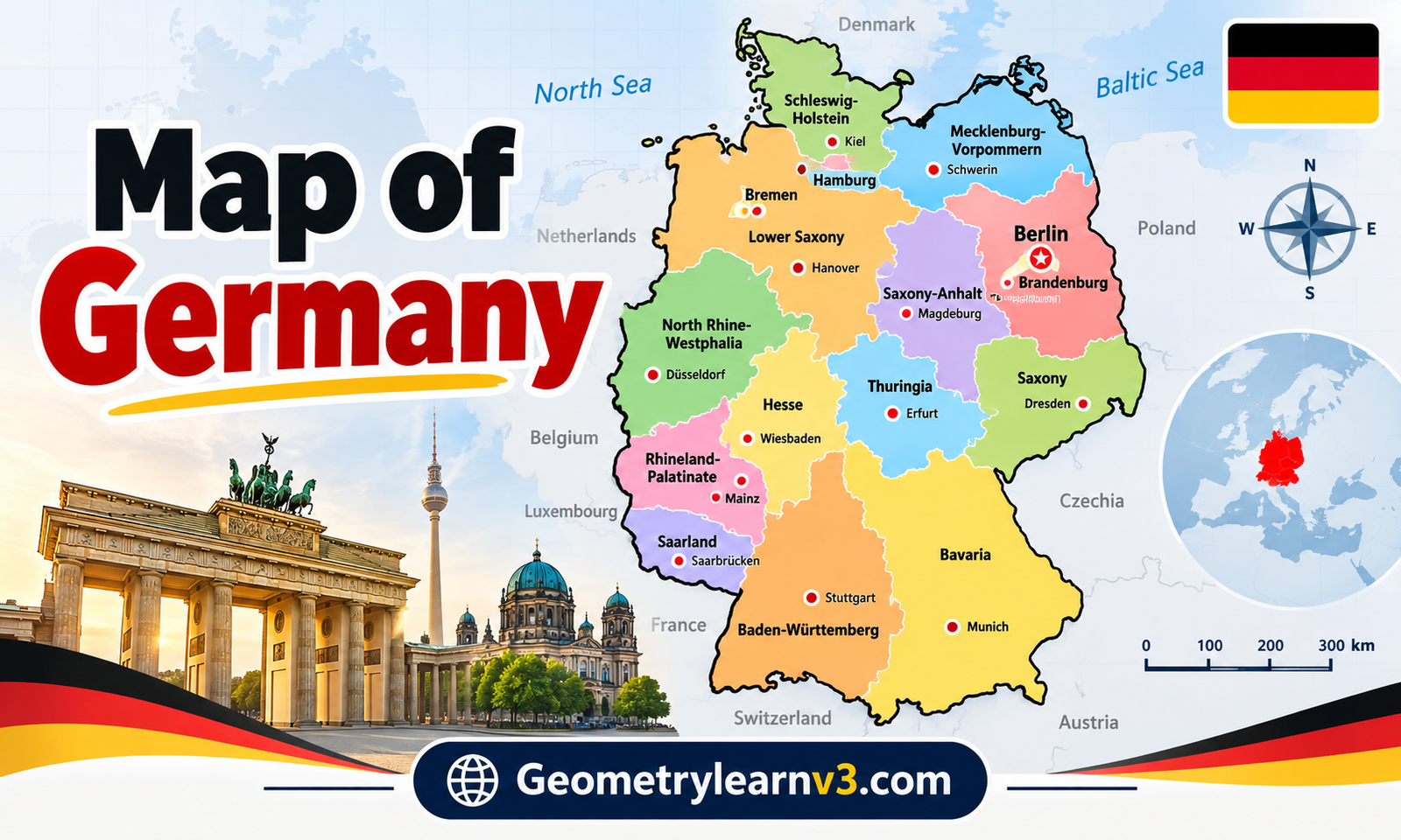
Germany is one of the most influential countries in Europe, recognised for its fascinating history, advanced economy, cultural traditions, and diverse landscapes. Understanding the country’s geography becomes much easier when using a detailed map of Germany that highlights its states, major cities, regions, borders, and natural features. Whether someone is a student learning geography, a traveller planning a European adventure, or a researcher exploring European countries, maps provide a clear visual understanding of Germany’s structure and location.
A map of Germany offers more than just locations and boundaries. It reveals the relationship between different regions, shows how cities developed around rivers and trade routes, and explains why certain areas became important cultural or economic centres. From the coastal regions in the north to the Alpine landscapes in the south, Germany’s geography reflects centuries of historical development and natural diversity.
Understanding the Map of Germany and Its Location in Europe
Germany is positioned in the centre of Europe, making it one of the continent’s most connected nations. A map of Germany shows that the country shares borders with nine different countries, including Denmark to the north, Poland and the Czech Republic to the east, Austria and Switzerland to the south, and France, Luxembourg, Belgium, and the Netherlands to the west. This central position has made Germany an important location for transportation, business, and cultural exchange throughout history.
The geographical location displayed on a Germany map explains why the country has played a major role in European development. Germany stretches from the North Sea and Baltic Sea in the north to the Alps in the south, creating different climate zones and landscapes. Its central location allows easy connections between Western, Eastern, Northern, and Southern Europe, making it a key destination for tourism and international trade.
Map of Germany With States and Capitals
A map of Germany with states displays the country’s federal organisation and its division into 16 states, also known as Bundesländer. Each state has its own government, capital city, traditions, and unique characteristics. These states have different landscapes, industries, and cultural identities, which contribute to Germany’s overall diversity and regional importance.
Some of the most famous states include Bavaria, which has Munich as its capital and is known for its Alpine scenery and traditions. Berlin is both a city and a federal state, serving as Germany’s capital and political centre. North Rhine-Westphalia, with Düsseldorf as its capital, is one of the country’s most populated and economically important regions. Studying a Germany states map helps people understand how the country is organised.
Major Cities on the Map of Germany
The major cities shown on the map of Germany represent important centres of government, business, culture, and tourism. Berlin is the largest and most internationally recognised city, famous for its history, museums, architecture, and modern lifestyle. Munich is another important city, known worldwide for its traditions, technology companies, and cultural events.
Other major cities include Hamburg, Frankfurt, Cologne, Stuttgart, Düsseldorf, and Leipzig. Hamburg is a major port city connected to international trade, while Frankfurt is known as a global financial centre. Cologne attracts visitors with its historic cathedral and cultural attractions. A map of Germany with cities helps travellers, students, and businesses understand the locations and importance of these urban areas.
Physical Map of Germany: Mountains, Rivers, and Landscapes
A physical map of Germany focuses on the country’s natural geography, including mountains, rivers, forests, and coastal areas. Germany has a wide variety of landscapes, from the flat northern plains to the mountainous southern regions. The Bavarian Alps in the south are among the country’s most famous natural features, attracting millions of visitors every year.
Germany’s rivers are also important geographical features shown on a detailed map of Germany. The Rhine River, Danube River, Elbe River, and Weser River have influenced settlement patterns, transportation, agriculture, and economic growth. These waterways connect different regions and have supported communities for centuries. The combination of mountains, rivers, forests, and coastlines makes Germany geographically diverse.
Regional Map of Germany: North, South, East, and West
A regional map of Germany helps explain the differences between the country’s major areas. Northern Germany is known for its coastal landscapes, maritime culture, and important port cities such as Hamburg. The region includes the North Sea and Baltic Sea coastlines, making it popular for tourism and shipping activities.
Southern Germany is famous for Bavaria, the Alps, traditional villages, and scenic landscapes. Western Germany contains important industrial areas and historic cities, while Eastern Germany has unique cultural influences shaped by its history. Exploring the regions on a map of Germany allows people to understand how geography, history, and traditions have created different identities across the country.
Map of Germany for Travel and Tourism
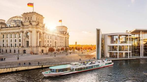
A travel map of Germany is an essential tool for visitors who want to explore the country’s attractions, cities, and natural beauty. Germany offers a wide range of experiences, including historic castles, modern cities, scenic countryside, and cultural festivals. Maps help travellers create routes that connect different destinations efficiently.
Popular attractions visible on many Germany travel maps include Neuschwanstein Castle, the Black Forest, the Rhine Valley, Berlin landmarks, and traditional Bavarian towns. Transportation networks, including railways, airports, and highways, are also important features for travellers. Using a tourist map of Germany makes it easier to plan journeys and discover hidden locations throughout the country.
Political Map of Germany and Administrative Boundaries
A political map of Germany focuses on human-made boundaries, including state borders, administrative divisions, capital cities, and neighbouring countries. This type of map is especially useful for understanding Germany’s federal system and how different states are organised.
Unlike a physical map, a political map does not mainly focus on mountains, rivers, or landscapes. Instead, it shows how the country is divided and governed. Students, researchers, and travellers often use political maps to learn about state locations, regional boundaries, and Germany’s relationship with surrounding European nations.
Detailed Map of Germany: How to Read and Use It
A detailed map of Germany provides a complete view of the country by combining information about cities, roads, rivers, borders, and geographical features. Learning how to read these maps helps users find locations quickly and understand connections between different regions.
Different maps are designed for different purposes. A road map helps drivers plan routes, a political map explains state boundaries, and a physical map shows natural landscapes. A detailed map of Germany combines these elements to provide a complete geographical overview for education, travel, and research.
Conclusion
The map of Germany provides valuable insight into the country’s states, capitals, cities, regions, and natural features. By exploring Germany through maps, people can better understand how geography influences culture, history, transportation, and economic development. The country’s central European location, diverse landscapes, and regional differences make it one of the most interesting places to study.
Whether used for travel planning, educational purposes, or general knowledge, a detailed map of Germany helps people discover the structure and beauty of this European nation. From the northern coastlines to the southern Alps, Germany’s geography tells a story of diversity, connection, and historical importance.
Frequently Asked Questions
What information does a map of Germany show?
A map of Germany shows states, capitals, cities, borders, rivers, mountains, regions, and important landmarks.
How many states are there on the map of Germany?
Germany has 16 federal states, known as Bundesländer, each with its own capital and regional features.
What are the largest cities shown on the map of Germany?
The largest cities include Berlin, Hamburg, Munich, Cologne, Frankfurt, Stuttgart, and Düsseldorf.
Where is Germany located in Europe?
Germany is located in central Europe and shares borders with nine neighbouring countries.
Which map of Germany is best for travellers?
A detailed travel map of Germany is best for finding cities, attractions, roads, and transportation routes.
You May Also Read: Try