

The Andes Mountains are one of the most remarkable mountain systems on Earth, stretching across the western side of South America. The Andes Mountains map provides a clear visual guide to understanding the location, countries, landscapes, and important geographical features of this enormous mountain range. From the northern regions of Colombia and Venezuela to the southern areas of Chile and Argentina, the Andes shape the geography, climate, and culture of many countries.
A detailed Andes Mountains map is useful for students, travelers, researchers, and geography enthusiasts who want to explore this famous mountain range. It helps identify major peaks, mountain sections, valleys, plateaus, volcanoes, and nearby regions. By studying the map, people can better understand how the Andes influence weather patterns, ecosystems, human settlements, and natural resources throughout South America.
Andes Mountains Map Location and Geographic Overview
The Andes Mountains are located along the western edge of South America, forming a long natural barrier between the Pacific Ocean and the interior parts of the continent. The mountain range extends through several countries and covers thousands of miles, making it the longest continental mountain range in the world. The Andes Mountains map clearly shows how this massive chain follows the coastline of South America.
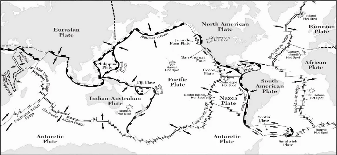
The Andes begin in the northern part of the continent and continue southward through different environments, including tropical forests, dry deserts, high-altitude plains, and icy landscapes. Their location near the Pacific Ring of Fire makes the region famous for volcanic activity and earthquakes. A geographical map helps readers understand the connection between the Andes, nearby cities, rivers, oceans, and surrounding landscapes.
Countries Shown on the Andes Mountains Map
The Andes Mountains extend across seven South American countries, and each country contains unique landscapes and cultural connections with the mountain range. A labeled Andes Mountains map makes it easier to identify these countries and understand how the mountains pass through different regions. The countries connected with the Andes include Venezuela, Colombia, Ecuador, Peru, Bolivia, Chile, and Argentina.
In Colombia, the Andes divide into three major branches that influence the country’s geography and cities. Ecuador is known for its impressive volcanic peaks, including Cotopaxi and Chimborazo. Peru contains some of the most famous Andean locations, including Machu Picchu and ancient Inca sites. Bolivia is home to the high Altiplano plateau, while Chile and Argentina contain some of the tallest and most dramatic sections of the mountain range.
Physical Map of the Andes Mountains and Major Landforms
A physical Andes Mountains map shows more than just location. It explains the height, shape, and structure of the mountain range through elevation markings, colors, and terrain details. These maps help users understand how the Andes rise from low coastal areas to some of the highest peaks in the world. They are especially helpful for learning about mountain formation and natural landscapes.
The Andes are divided into three main sections: the Northern Andes, Central Andes, and Southern Andes. Each section has different physical features. The Northern Andes contain tropical mountain environments, the Central Andes include wide plateaus and volcanic areas, and the Southern Andes feature glaciers, snowy peaks, and rugged terrain. Valleys, rivers, volcanoes, and mountain passes are also important features shown on detailed maps.
Major Peaks and Famous Locations on the Andes Mountains Map
The Andes contain many famous mountains and landmarks that attract visitors and researchers from around the world. The Andes Mountains map helps locate these important peaks and destinations with greater accuracy. The most famous peak in the range is Mount Aconcagua, located in Argentina. It is the highest mountain in the Andes and one of the tallest mountains outside Asia.
Other important peaks include Huascarán in Peru, Chimborazo and Cotopaxi in Ecuador, and several active volcanoes across the mountain chain. The Andes are also home to famous cultural and natural locations such as Machu Picchu, Lake Titicaca, and the Altiplano region. These places show the deep connection between geography, history, and human life in the Andes.
Climate, Wildlife and Ecosystems of the Andes Region
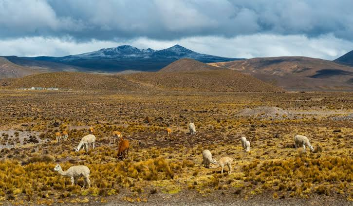
The Andes create a wide variety of climates because of their extreme length and elevation changes. A detailed Andes Mountains map helps explain how different environments exist within the same mountain system. Lower areas may have warm tropical conditions, while higher elevations can experience freezing temperatures, snow, and glaciers throughout the year.
The diverse climate supports many unique ecosystems and wildlife species. The Andes are home to animals such as llamas, alpacas, Andean condors, and many rare mountain species. Forests, grasslands, wetlands, and high-altitude deserts create habitats for thousands of plants and animals. These ecosystems are important for conservation because many species depend on the special conditions created by the Andes mountain environment.
Importance and Uses of the Andes Mountains Map
The Andes Mountains map is an important resource for education, tourism, scientific research, and environmental studies. Geography students use maps to learn about mountain ranges, countries, elevation, and natural features. Teachers often use labeled maps to explain how mountains influence climate, rivers, and human settlements.
Travelers and explorers also depend on maps when planning trips across the Andes. Hikers use them to understand mountain trails, elevations, and difficult terrain. Scientists use advanced maps to study geological activity, climate changes, glaciers, and biodiversity. Modern digital maps have made it easier for people worldwide to explore the Andes and understand their importance without visiting the region.
Interesting Facts About the Andes Mountains
The Andes Mountains are one of the most impressive geographical features on Earth. They stretch across a large part of South America and contain some of the highest peaks in the Western Hemisphere. The mountain range was created millions of years ago through tectonic activity, which continues to shape the region today.
The Andes have played an important role in human history, especially for ancient civilizations such as the Inca Empire. Many communities still depend on the mountains for agriculture, water resources, and cultural traditions. The combination of natural beauty, geological importance, and historical value makes the Andes one of the most studied mountain systems in the world.
Conclusion
The Andes Mountains map provides valuable information about one of the world’s greatest mountain ranges. It allows people to explore the location, countries, physical features, major peaks, and ecosystems that make the Andes unique. Whether used for learning, travel planning, or scientific research, maps help explain the importance of this massive natural landmark.
Understanding the Andes through maps also shows how geography affects climate, wildlife, and human communities. From the highest peaks of Argentina to the ancient landscapes of Peru, the Andes represent a powerful connection between nature and history. A detailed map makes this incredible mountain range easier to explore and appreciate.
FAQs
Where are the Andes Mountains located?
The Andes Mountains are located along the western side of South America, stretching from Venezuela and Colombia to Chile and Argentina.
Which countries are shown on the Andes Mountains map?
The Andes Mountains map includes Venezuela, Colombia, Ecuador, Peru, Bolivia, Chile, and Argentina.
What is the highest peak in the Andes Mountains?
Mount Aconcagua in Argentina is the highest peak in the Andes Mountains.
Why is an Andes Mountains map important?
It helps people understand the location, geography, countries, peaks, and physical features of the Andes.
What does a physical Andes Mountains map show?
A physical map shows elevation, mountains, valleys, volcanoes, glaciers, and other landforms.
Are the Andes Mountains volcanic?
Yes, many parts of the Andes have volcanic activity because the region is located near the Pacific Ring of Fire.
You May Also Read: Rex Heuermann Wife