

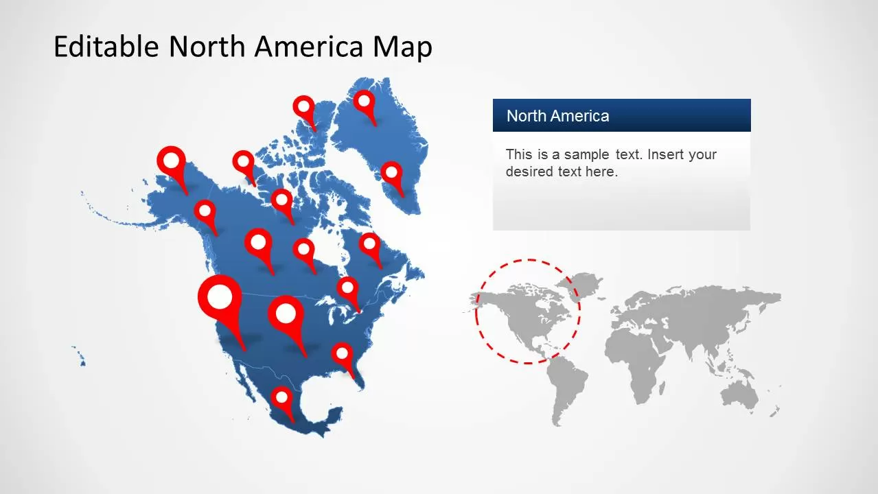
A North America map is a valuable resource for understading the location, size, borders, countries, cities, and natural features of one of the world’s most diverse continents. It provides a visual representation of North America’s geography and helps students, travelers, researchers, and geography enthusiasts explore the continent in a simple and organized way. From the icy Arctic regions of Canada and Greenland to the tropical islands of the Caribbean, a detailed map reveals the incredible variety of landscapes and cultures found across this vast area.
Studying a North America map makes it easier to understand how different countries are connected and how geography influences people’s lifestyles, economies, and environments. The continent includes powerful nations, historic regions, and important natural landmarks that have shaped global development. Whether someone is learning about world geography, planning a trip, or researching countries, maps provide essential information about locations, distances, and regional relationships.
Location and Geographic Overview of North America
North America is the third-largest continent on Earth and covers a massive area extending from the Arctic Circle in the north to the tropical regions near the Caribbean Sea in the south. A North America map shows that the continent is surrounded by major bodies of water, including the Arctic Ocean to the north, the Atlantic Ocean to the east, and the Pacific Ocean to the west. These geographic boundaries make North America a unique region with diverse climates and ecosystems.
The continent covers approximately 24.7 million square kilometers and contains a wide range of physical environments. From frozen tundra and vast forests to deserts, mountains, and coastal plains, North America has some of the most varied landscapes in the world. A geographic map helps people understand the relationship between landforms, climate zones, and human settlements across the continent.
North America Map With Countries and Capitals
A detailed North America map highlights the countries, territories, and capital cities that make up the continent. The largest and most well-known countries are Canada, the United States, and Mexico, which together cover most of North America’s land area. These nations have major global influence because of their economies, populations, natural resources, and cultural contributions.
Beyond the three largest countries, North America also includes nations in Central America and the Caribbean. Countries such as Guatemala, Costa Rica, Panama, Cuba, Jamaica, and the Dominican Republic are important parts of the continent. A labeled map helps users identify these countries and learn their locations, capitals, and geographical connections.
The capital cities shown on a North America map provide important information about political centers. Ottawa is the capital of Canada, Washington, D.C. is the capital of the United States, and Mexico City is the capital of Mexico. Each capital represents the government, history, and cultural identity of its country.
Political Map of North America and Borders
A political North America map focuses on country boundaries, states, provinces, territories, and administrative divisions. This type of map is commonly used in schools, government studies, and travel planning because it clearly displays how the continent is divided into different regions.
Political maps help users understand international borders and relationships between neighboring countries. Canada shares a long border with the United States, while Mexico connects North America with Central America. These borders influence trade, transportation, migration, and cultural exchanges throughout the continent.
The political divisions within countries are also important. Canada is divided into provinces and territories, the United States contains 50 states, and Mexico has multiple states with their own governments. A North America map showing these divisions provides a deeper understanding of how the continent is organized.
Physical Features and Natural Landforms of North America
A physical North America map displays the natural features that shape the continent, including mountains, rivers, lakes, deserts, forests, and plains. These features influence climate, wildlife, agriculture, and human settlements. Understanding physical geography helps explain why different regions have unique environments and lifestyles.
The Rocky Mountains are one of the most significant mountain systems in North America, stretching through western parts of Canada and the United States. Other important landforms include the Appalachian Mountains in the east, the Sierra Madre mountain ranges in Mexico, and the Great Plains that extend across central regions.
North America also contains important waterways such as the Mississippi River, the Colorado River, and the Great Lakes. These natural resources support transportation, farming, industry, and ecosystems. A physical map allows people to explore how rivers, mountains, and landscapes shape the continent.
Regions of North America and Their Diversity
North America is often divided into three major regions: Northern America, Central America, and the Caribbean. Each region has different geography, cultures, climates, and economic activities. A North America map helps users understand the location and characteristics of these areas.
Northern America includes Canada, the United States, and Greenland. This region features large forests, Arctic landscapes, modern cities, and important industrial centers. Central America connects North America with South America and includes countries known for tropical forests, volcanoes, and coastal environments.
The Caribbean region includes many islands located in the Caribbean Sea. These islands are known for their beaches, marine ecosystems, and cultural traditions. Together, these regions create the diverse geographical and cultural identity of North America.
Major Cities and Important Places on North America Map
A North America map also shows the locations of major cities that play important roles in business, tourism, culture, and transportation. Cities such as New York City, Los Angeles, Toronto, Vancouver, Mexico City, Chicago, and Miami are among the most recognized urban centers on the continent.
These cities attract millions of residents and visitors because of their economic opportunities, historical attractions, and cultural diversity. Maps help people understand where these cities are located and how they connect through roads, airports, and transportation networks.
Important natural and cultural landmarks can also be explored through maps. Popular locations include national parks, historic sites, mountain ranges, and coastal destinations. A detailed map makes it easier to discover the many attractions found across North America.
Climate Zones and Environment of North America
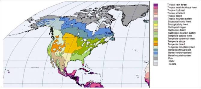
North America has one of the widest ranges of climate conditions in the world. A climate-focused North America map shows regions with Arctic, temperate, desert, Mediterranean, and tropical climates. These climate differences are caused by the continent’s large size, mountain ranges, ocean influences, and geographic position.
The northern parts of Canada experience extremely cold Arctic conditions, while southern areas such as Mexico and the Caribbean have warmer tropical climates. Between these extremes are forests, grasslands, deserts, and agricultural regions that support different forms of life and human activity.
The continent is home to diverse ecosystems, including the Canadian boreal forest, Mexican deserts, tropical rainforests, and coastal wetlands. These environments provide habitats for thousands of plant and animal species and play an important role in maintaining global biodiversity.
How to Use a North America Map for Learning and Travel
A North America map can be used for many purposes, including education, travel planning, research, and general knowledge. Students use maps to learn countries, capitals, borders, and physical features, while travelers use them to understand destinations and transportation routes.
Reading a map requires understanding basic features such as symbols, labels, directions, and scale. Political maps provide information about countries and cities, while physical maps focus on natural landscapes. Digital maps add interactive features that allow users to explore locations with satellite images and detailed information.
Whether someone is studying geography or planning a journey, maps provide a clear view of the continent. They make complex geographical information easier to understand and help people explore North America with confidence.
Interesting Facts About North America
North America is home to many fascinating geographical and cultural facts. It contains some of the largest countries in the world, including Canada and the United States, and includes some of the most impressive natural wonders on Earth. A North America map reveals the incredible size and diversity of this continent.
The continent contains the world’s largest freshwater lake system, the Great Lakes, and some of the longest mountain ranges and rivers. It also has a rich history influenced by Indigenous cultures, immigration, exploration, and economic development.
Exploring a North America map provides a deeper appreciation of the continent’s geography, people, and natural beauty. It shows how different regions are connected and why North America remains one of the most important areas in the world.
Conclusion
A North America map is an essential tool for discovering the countries, cities, regions, landscapes, and natural features of the continent. It provides valuable information about political boundaries, physical geography, climate zones, and important locations that shape North America.
From educational purposes to travel planning, maps help people understand the complexity and beauty of the continent. By exploring a detailed North America map, readers can gain knowledge about its geography, history, and cultural diversity while developing a stronger connection with one of the world’s most fascinating regions.
FAQs
How many countries are shown on a North America map?
A North America map usually shows 23 independent countries, including nations in mainland North America, Central America, and the Caribbean.
What are the largest countries on the North America map?
Canada, the United States, and Mexico are the three largest countries shown on the map.
What oceans surround North America?
North America is surrounded by the Arctic Ocean, Atlantic Ocean, Pacific Ocean, and Caribbean Sea.
Why is a North America map useful for students?
A map helps students learn countries, capitals, borders, physical features, and important geographic locations.
What is the difference between a political and physical North America map?
A political map shows countries and borders, while a physical map highlights mountains, rivers, lakes, and natural landscapes.
Which major landmarks can be found on a North America map?
Major landmarks include the Rocky Mountains, Great Lakes, Mississippi River, Grand Canyon, and famous national parks.
You May Also Read: Rat Tailed Maggot